Glossary
A-Z
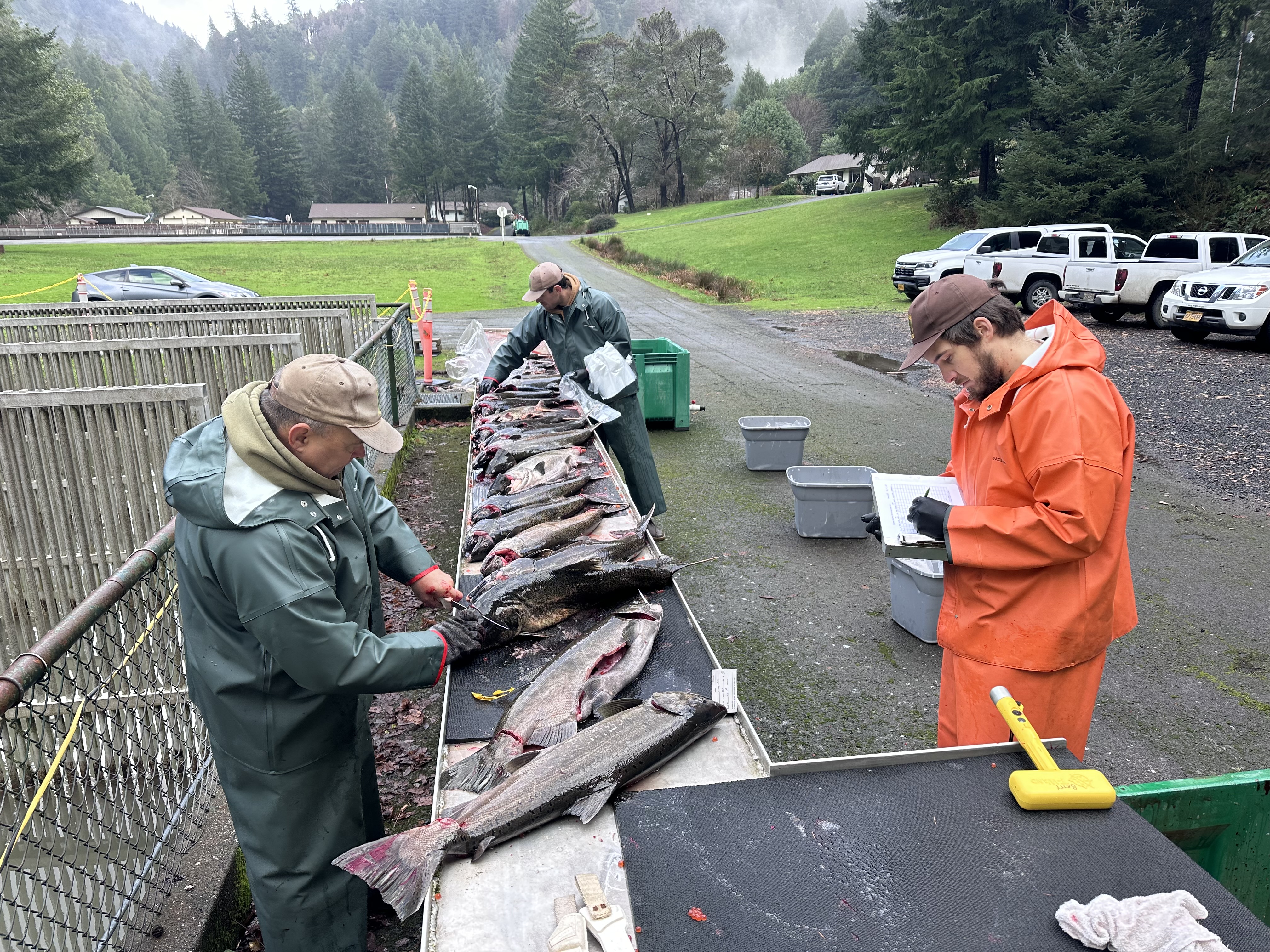
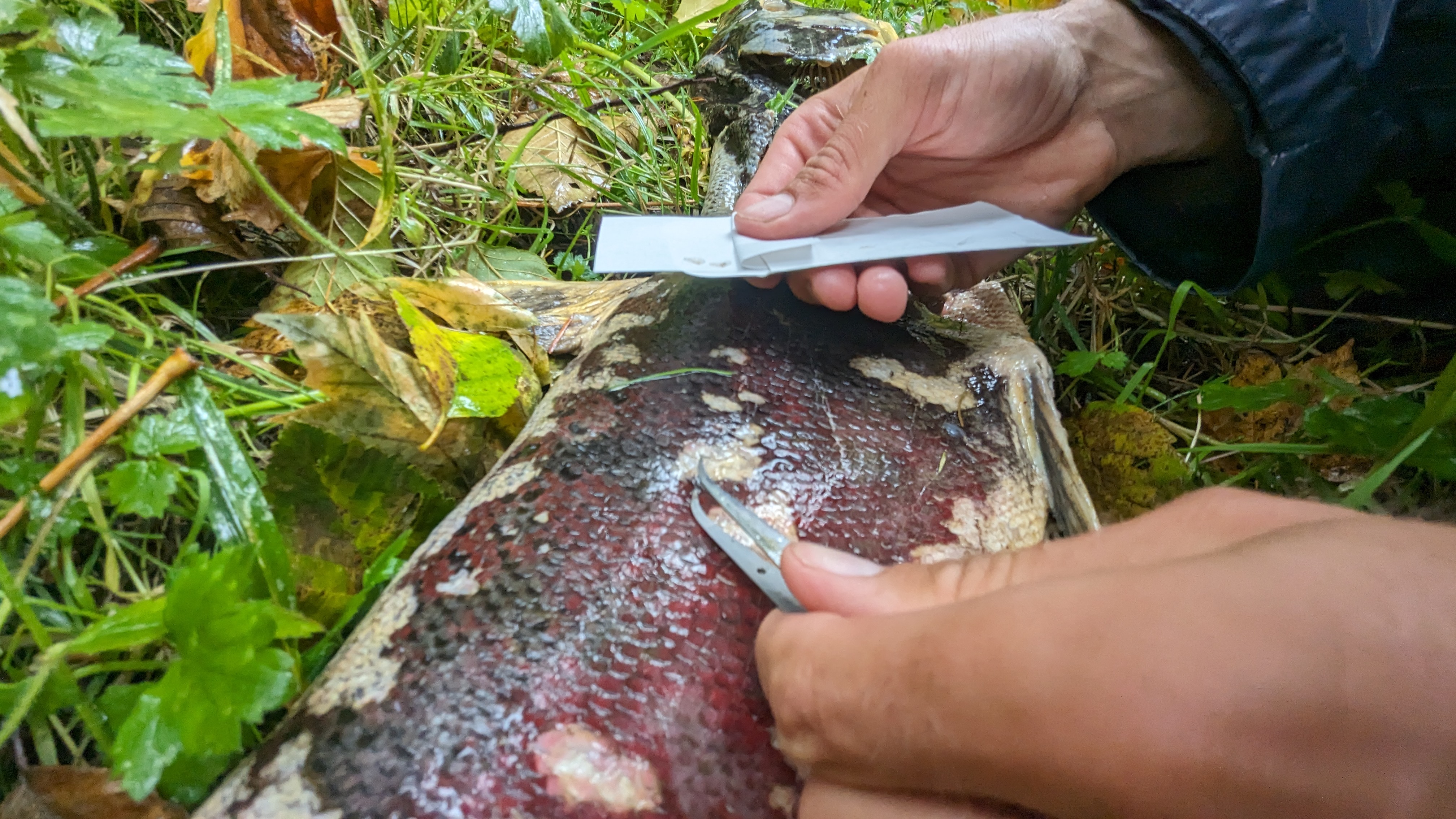
CWT: Coded wire tag. CWTs are small lengths of metal wire that are inserted into the snouts of young fish, usually (although not always) as part of a hatchery program. Each bit of wire is printed with a code that relates to the basin and year that a given fish originates from. CCRMP field staff use wands to scan fall Chinook Salmon carcasses for CWTs and retain the snouts of carcasses that test positive. At the end of the season, the snouts are sent to ODFW's CWT Recovery Lab in Clackamas where the CWTs are removed and read. The tag information is then incorporated into the CCRMP database, an ODFW tag database, and RMIS (Regional Mark and Information System) a database managed by the Regional Mark Processing Center of the Pacific States Marine Fisheries Commission Home - Regional Mark Processing Center (rmpc.org) Anglers who receive a SNID (snout identification number) card from ODFW employees during a creel survey can look up where their fish originated from on ODFW's website here ODFW - Marine Resources Program - Ocean Salmon Management Coded Wire Tag Look-Up (state.or.us) .
e-Creel: Electronic Creel. e-Creel is a novel method of conducting creel that combines in-person interviews with harvest data reported through ELS (ODFW's Electronic Licensing System database). Creel surveys are a means to estimate catch (harvest and release) of salmon through recreational angler interviews at popular fishing access points. Creel surveyors also collect biological information from harvested fish which may include length, sex, fish origin (hatchery versus wild), scale samples (for ageing fish), snouts (for Coded Wire Tags), and tissue samples for DNA analysis. For fall Chinook Salmon, CCRMP field staff conduct creels on many of the coastal inland fisheries. Coastal inland fisheries are defined as fish harvested in the rivers, bays, estuaries, or from the mouth of a river or jetty tips inland. Outside the jetty tips or mouth is considered an ocean harvested salmon. For more information on e-Creel methodologies, see Riggers and Jones 2022.
e-Creel harvest estimate: Harvest estimate derived from e-Creel studies. Because these studies use a combination of ELS data and data gathered through in-person interviews, the resulting estimates often differ from those that solely utilize ELS data. One reason this may occur is because anglers sometimes enter the wrong location code when they tag their harvest in ELS. For example, they may mistakenly enter an ocean-specific location code with a similar name as the inland river or bay that they harvested in. When our e-Creel surveyors intercept these anglers, they can recognize the mistake and direct anglers to the appropriate location code for the area the harvest occurred in, and over the course of a season we can generate a marine location code error rate for each basin with e-Creels to produce more accurate harvest estimates. The e-Creel harvest estimate may also differ and may be more precise than the ELS harvest estimate given in-person interviews allow us to determine if anglers are tagging their jacks (which are not required to be reported in the ELS database), to determine if species identification was correct, and to determine non-compliance rates (situations where anglers do not tag their fish as required). The e-Creel harvest estimate uses a capture-recapture equation typical of mark-recapture studies to determine harvest.
ELS: Electronic Licensing System. Database containing e-tagged fish and other harvest and angler information. In December 2018, the Oregon Department of Fish and Wildlife (ODFW) implemented an Electronic Licensing System (ELS) to administer hunting and fishing licenses and harvest tags, enhance regulatory enforcement, and increase managerial and process efficiencies. With this modernization, ODFW anticipates an annual $2 million cost savings once all functionalities are realized (https://myodfw.com/ELS). Since ODFW implementation, anglers have the choice of tagging their harvest either in using ELS or through traditional paper tags. Electronic licenses may be purchased at: Oregon DFW - Login (huntfishoregon.com).
ELS harvest estimate: Electronic Licensing System harvest estimate. Harvest estimate that is generated solely using ELS data. This estimate uses statewide sales ratios of electronic tags to total tags (paper and electronic tags).
EIS: Escapement Indicator Stock. Stocks of fall Chinook Salmon within a management aggregate that are used to indicate how much of that aggregate returns to spawn (or escape exploitation). EIS in the North Oregon Coast (NOC) aggregate include the Nehalem, Siletz, and Siuslaw basins. EIS in the Mid Oregon Coast (MOC) aggregate include the Umpqua and Coquille basins.
ERIS: Exploitation Rate Indicator Stock. Stocks of fall Chinook Salmon within a management aggregate that are used to indicate how much of that aggregate is exploited before spawning. The Salmon River and Elk River Hatcheries produce the North Oregon Coast (NOC) and Mid Oregon Coast (MOC) ERIS, respectively.
Mark-recapture. A method used to determine population size, often employed when it is impractical to count every individual in a population. See Our Research Section.
MOC: Mid Oregon Coast aggregate. These are the Pacific Salmon Treaty (PST) stocks of fall Chinook Salmon that spawn in Oregon river basins from the Umpqua in the north to the Elk in the south. While at sea, MOC salmon migrate north, reaching Canadian and Alaskan waters where they are subject to harvest. Thus, they are managed cooperatively by US states and Canada through the PST.
NOC: North Oregon Coast aggregate. These are the Pacific Salmon Treaty (PST) stocks of fall Chinook Salmon that spawn in Oregon river basins from the Necanicum in the north to the Siuslaw in the south. While at sea, NOC salmon migrate north, reaching Canadian and Alaskan waters where they are subject to harvest. Thus, they are managed cooperatively by US states and Canada through the PST.
PSC: Pacific Salmon Commission. The governing body of the Pacific Salmon Treaty (PST).
PST: Pacific Salmon Treaty. Ratified in 1985 by the US and Canada in order to manage, monitor, and enhance Pacific salmon stocks of mutual concern.
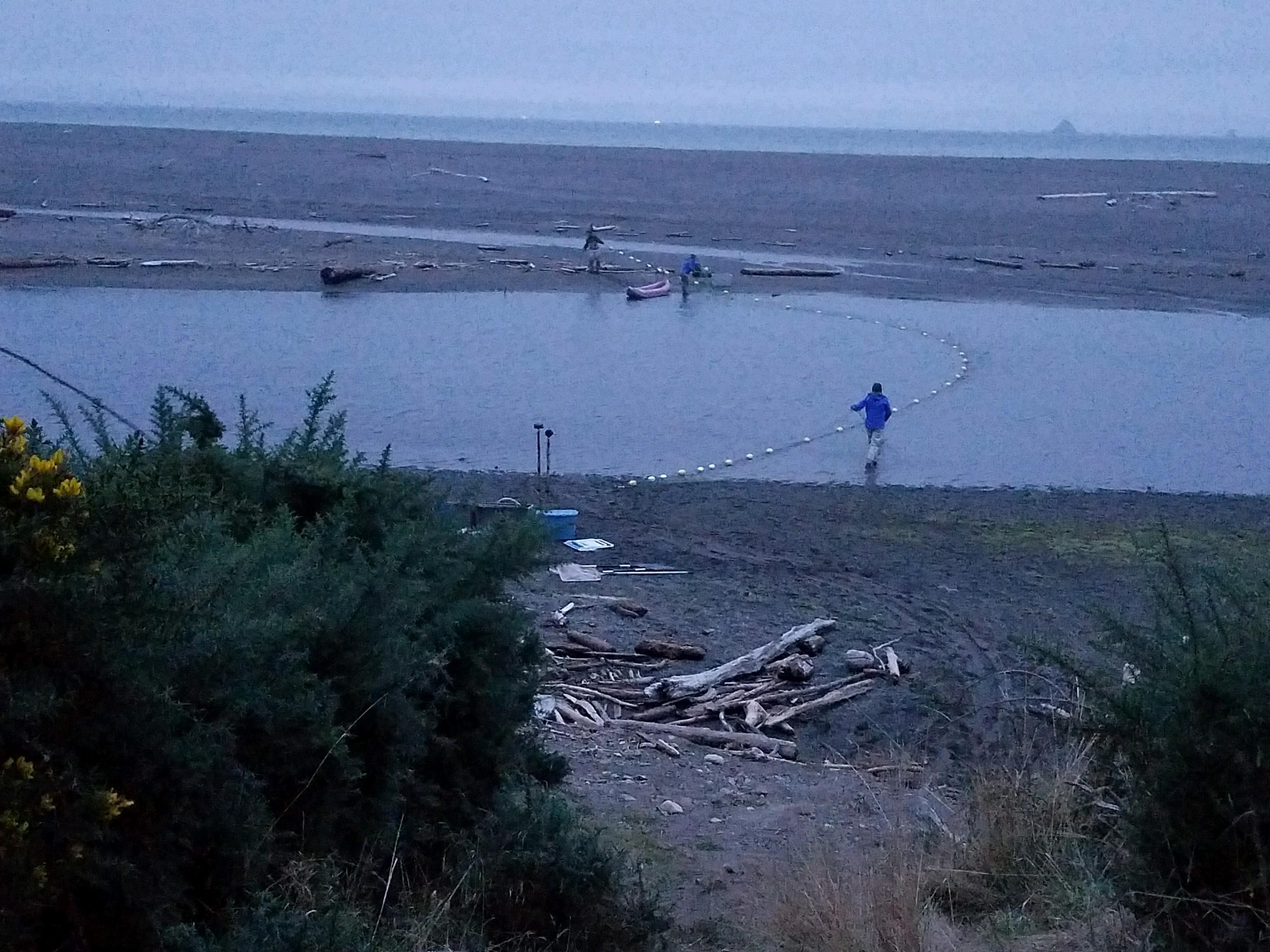
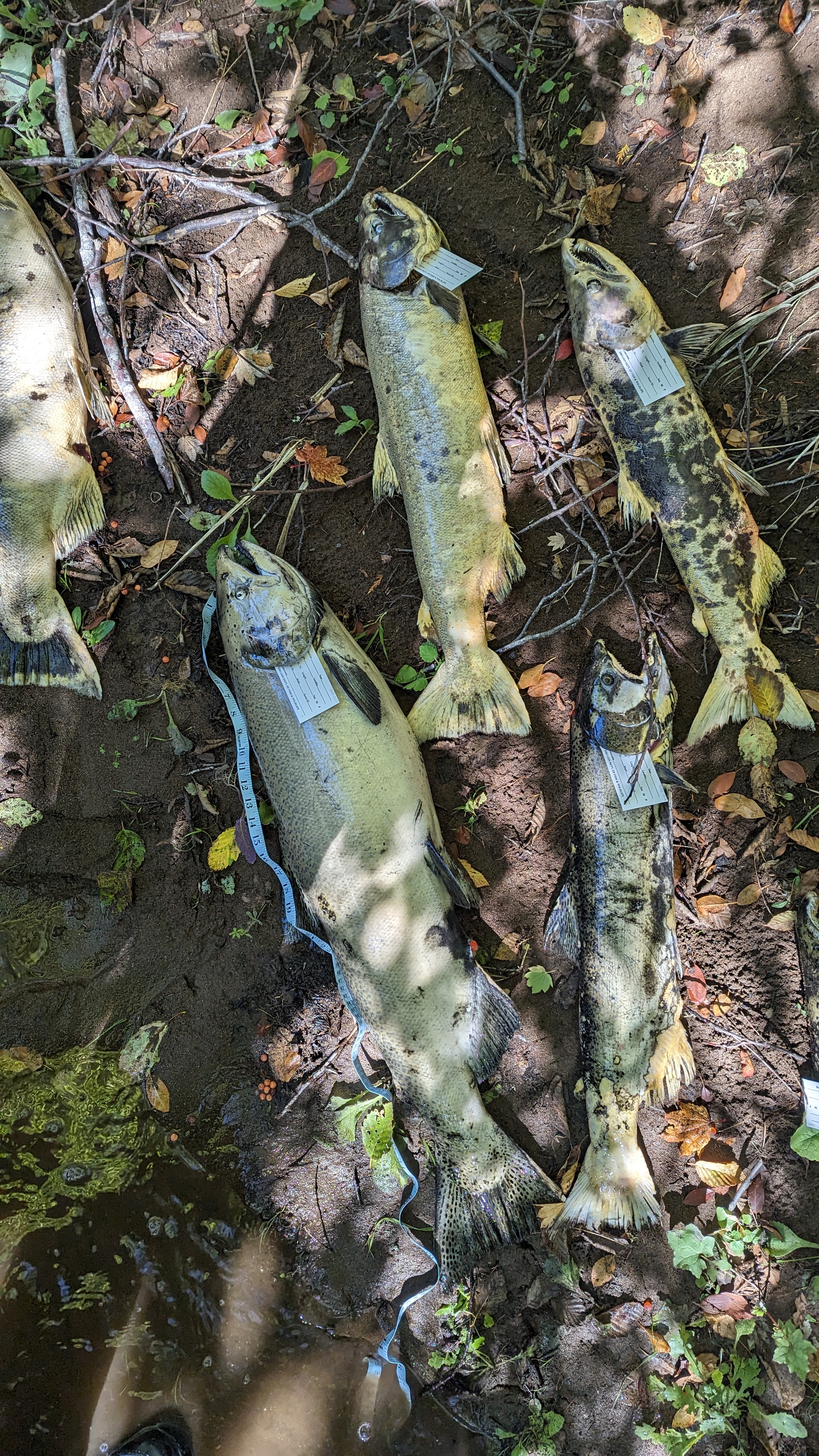
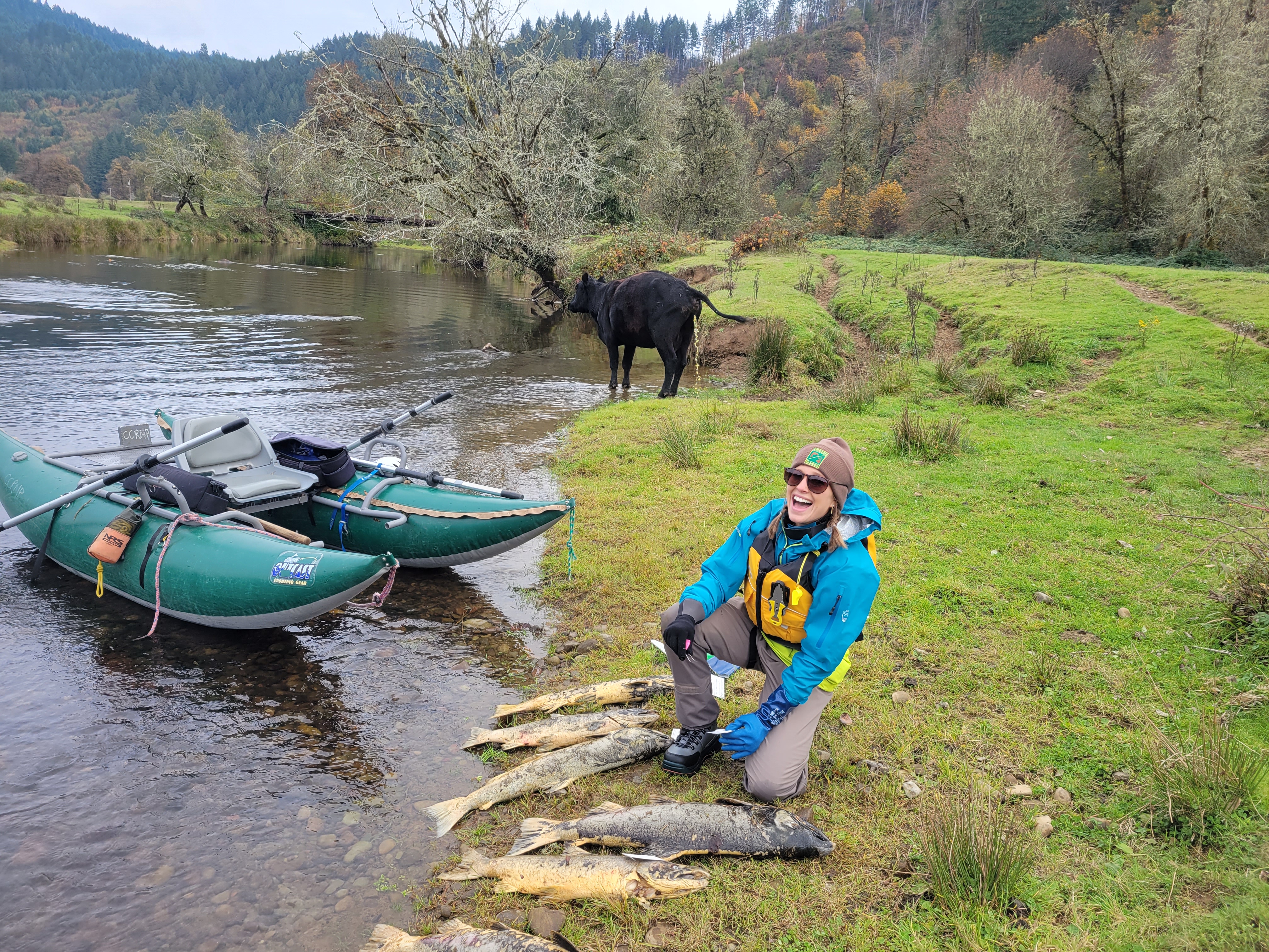
SGS: Spawning Ground Surveys. A methodology for estimating escapement, or how many salmon return to spawn. For fall Chinook Salmon, CCRMP field staff conduct SGS by foot and cataraft on select tributary streams and mainstem reaches where Chinook are known to spawn. In each survey, all salmon seen are identified to species, and all live salmon, dead salmon, and redds seen are tallied. Fish behavior (migrating, holding, actively spawning, post-spawn) is noted, as well as environmental conditions such as flow level and weather. Flow and weather may affect visibility and thus counts. All recoverable carcasses are collected and sampled for biological information. Biological information may include length, sex, fish origin (hatchery versus wild), scale samples (for ageing fish), snouts (for Coded Wire Tags), and tissue samples for DNA analysis.